ASCII-Grid DTM
The file format „ASCII-Grid DTM“ is a non-proprietary ASCII format developed by ESRI used in conjunction with ArcView/ArcInfo (file extension *.asc). Due to its simple file structure the format offers data exchange with ESRI software and other kinds of software. The ASCII file contains on rows and columns the local height z at coordinate xy.
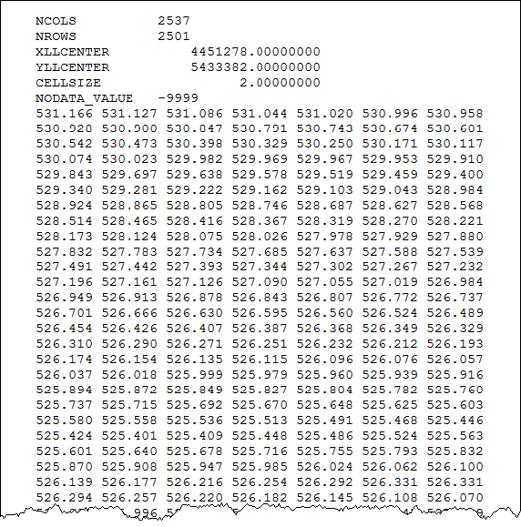
Example of file structure of an ASCII-Grid file
Options
Via the „Option“ button the following import settings are available:
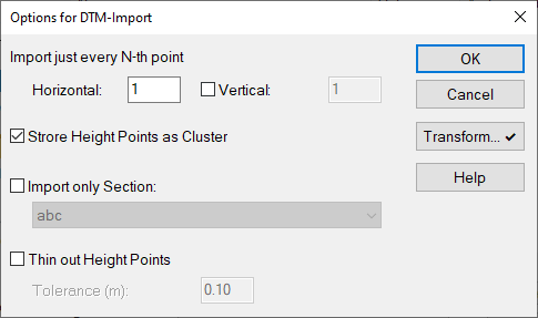
Dialog Options for DTM-Import
- Import just every N-th point: By this option the amount of data being imported - in special with large files - can be reduced during the import procedure already. Available settings:
- The default setting „Horizontal=1“ will import all points.
- By the setting - for example - „Horizontal=2“ only every second point will be imported, both in horizontal and vertical direction.
- By activating the option „Vertical“ distinct import sequences can be specified in x-direction (horizontal) and y-direction (vertical).
- Store Height Points as Cluster: With this option activated, the imported data is not stored as individual height points, but as contour line with option „Use Points as Height Points“ (see Height Point).
- Import only section: see Import only Section
- Thin out Height Points: see Thin out Height Points
- Button "Transform": see Coordinate Transformation